FAQs
What are the existing polling district boundaries in the Municipality of Chester?
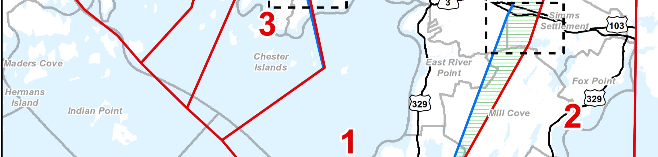
District 1
Blandford - East Chester area and includes Aspotogan, Bayswater, Northwest Cove, Blandford, Deep Cove, East River, East River Point, Otter Point, and part of East Chester.
Current Polling District 1 Map: https://chester.ca/sites/default/files/documents/related-documents/2020_electiondistricts1_municipal_modc.pdf
District 2
Hubbards to Mill Cove area and includes Mill Cove, Fox Point, Simms Settlement, Mill Lake, The Lodge, and Birchy Head.
Current Polling District 2 Map: https://chester.ca/sites/default/files/documents/related-documents/2020_electiondistricts2_municipal_modc.pdf
District 3
Chester area and includes Chester and part of East Chester.
Current Polling District 3 Map: https://chester.ca/sites/default/files/documents/related-documents/2020_electiondistricts3_municipal_modc.pdf
District 4
Chester Basin, Chester Grant, Borgels Point, and part of Middle River.
Current Polling District 4 Map: https://chester.ca/sites/default/files/documents/related-documents/2020_electiondistricts4_municipal_modc.pdf
District 5
Western Shore - Martin's River area and includes Gold River, Beech Hill, Western Shore, Martin's Point, and part of Martin's River, including East Side Martin's River.
Current Polling District 5 Map: https://chester.ca/sites/default/files/documents/related-documents/2020_electiondistricts5_municipal_modc.pdf
District 6
New Ross area and includes Seffernsville, New Ross, Leville, New Russell, Aaldersville, Harriston, Lake Ramsay, Forties, Franey Corner, and Fraxville.
Current Polling District 6 Map: https://chester.ca/sites/default/files/documents/related-documents/2020_electiondistricts6_municipal_modc.pdf
District 7
Windsor Road - Marriott's Cove area and includes Windsor Road, Canaan, Sherwood, Robinsons Corner, Marriotts Cove, Middle River Road, and part of Haddon Hill.
Current Polling District 7 Map: https://chester.ca/sites/default/files/documents/related-documents/2020_electiondistricts7_municipal_modc.pdf